Academic Chronicles & Updates

Center Activities & Latest News

Chronicles of our ongoing excavations, digital reconstructions, and academic milestones.

★ Featured UpdateGeneral News NRIAG, Helwan, Cairo, Egypt

Official Opening of BECAIVE & Training Workshop 1.0

We are proud to announce the official opening of the BECAIVE Centre and the launch of Training Workshop 1.0: Mapping the Innovation and Impact of Artificial Intelligence in Researching & Documenting Ancient Egyptian Heritage. Taking place from 17–22 August 2026 at NRIAG in Helwan, Cairo, with an optional field trip to Hawara Pyramid in Fayoum.

ARCHAEOLOGICAL RESEARCH DATABASE // SESHAT CORE
Sign up Form
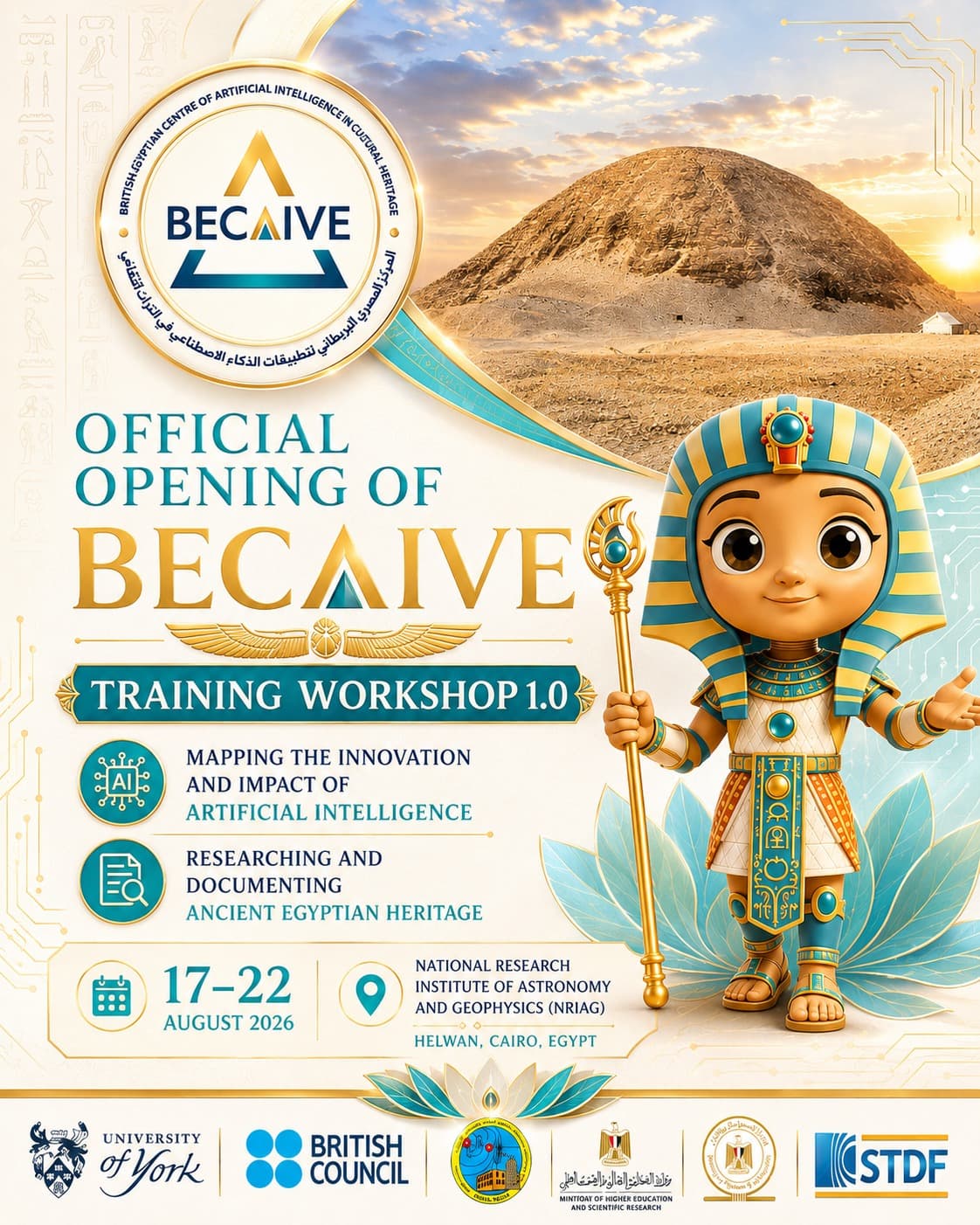
Official Opening of BECAIVE & Training Workshop 1.0
SESHAT_ENGINE v1.0.4 ONLINE
Gemini APIRAG RouterEmbeddingsKnowledge BaseVector IndexSeshat Agent
LATENCY: 142msCONTEXT WINDOW: 1M TOKENSACCURACY: 99.8%
AI & Innovation Cairo & York Offices

AI Companion Launch

The Center has officially launched Seshat, a state-of-the-art AI research companion powered by the Gemini API. Specially calibrated for Egyptian archaeology, digital epigraphy, and complex database queries, Seshat bridges the gap between raw field archives and active research. By utilizing advanced retrieval-augmented generation (RAG) over our synchronized databases, Seshat aids researchers in deciphering epigraphic logs, cross-referencing excavation reports, and navigating multi-layered digital heritage datasets with unprecedented accuracy.

REF: A1B2C3D4FIELD UPDATE
LiDAR SCANNER_GRIDRESOLUTION: 0.5MM
LAT: 29.2741° NLON: 30.8997° EPOINTS: 12.4BStation A
SURFACE INDEXED: 94.6%COMPRESSION: HDF5
Fieldwork Fayum Oasis, Egypt

Hawara 3D Scanning Phase Complete

A collaborative expedition between the University of York and the National Research Institute of Astronomy and Geophysics (NRIAG) has successfully wrapped up the high-fidelity 3D laser scanning phase of the Hawara Pyramid. Employing advanced terrestrial LiDAR scanning grids and aerial photogrammetric sensors, the joint team captured the exterior mudbrick envelope of the monument down to sub-millimeter precision. The resulting point-cloud data will form the geometric foundation of the Virtual Hawara Museum, preserving the deteriorating mudbrick surface in digital perpetuity.

REF: B2C3D4E5FIELD UPDATE
GPR_DEPTH_SLICEDEPTH: 4.5M
WALL ANOMALYCHAMBER ENTRANCE
ANTENNA: 400 MHzMAGNETOMETRY: SYNCD
Geophysics Lost Labyrinth Site

Geophysics Survey Update

Our geophysical exploration team has completed a comprehensive mapping campaign over the suspected perimeter of the Lost Labyrinth. Utilizing high-end Ground Penetrating Radar (GPR) and magnetometry datasets mapping the Lost Labyrinth area, these have been processed, aligned, and synchronized directly to our Virtual Database. The results, conducted in partnership with NRIAG, reveal strong structural anomalies at depths ranging from 3.5 to 6 meters, mirroring classic accounts of structured walls and chambers.

REF: C3D4E5F6FIELD UPDATE
CAPACITY_BUILDING● CLASS COMPLETED
01: CAPTURELiDAR / Image02: MESHAlignment03: TAGMetadata04: EXHIBITIONVirtual Museum
COHORT: 22 RESEARCHERSSTATUS: COMPLETE
Capacity Building Cairo Heritage Lab

Bilateral Training Workshop

The Center successfully completed the digital documentation training program for local researchers in Cairo, focusing on the Virtual Hawara Museum framework. Directed under the leadership of Professor Abdelmonem, the workshop trained over twenty Egyptian specialists in standard photogrammetry workflows, semantic metadata tagging, and interactive database structures, reinforcing long-term capacity for local heritage preservation.

REF: D4E5F6A7FIELD UPDATE